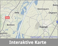
Size
|
|
| Project period |
|
| Project volume |
- about 9.4 Mio. EUR (including 50 % co-financing)
|
| Responsible body |
- Regierungspräsidium Karlsruhe (Regional Commission Karslruhe)
|
| Project partners |
|
| Administrative districts |
- Rastatt, city district of Baden-Baden
|
| Protection areas |
- Parts of the SAC (Special Area of Conservation according to the Habitats Directive) “Floodplain of the Rhine river between Wintersdorf and Karlsruhe”
- Parts of the SPA (Special Protection Area according to the Birds Directive) DE 7015-441 ”Rheinniederung Elchesheim – Karlsruhe“
- Parts of the SPA DE 7114-441 „Rheinniederung von der Rench- bis zur Murgmündung“
- Nature conservation area “Auenwälder und Feuchtwiesen westlich von Ötigheim“
- Nature conservation area “Auer Köpfle - Illinger Altrhein - Motherner Wörth“ (profile)
- Nature conservation area “Bremengrund“ (profile)
- Nature conservation area “Rastatter Bruch“ (profile)
- Nature conservation area “Rastatter Rheinaue“
- Nature conservation area “Rastatter Ried“ (profile)
- Nature conservation area “Rheinniederung zwischen Au am Rhein, Durmersheim und Rheinstetten“ (profile)
- Nature conservation area “Rottlichwald“ (profile)
- Nature conservation area “Seitel“ (profile)
- Nature conservation area “Silberweidenwald Steinmauern“ (profile)
- Nature conservation area “Tieflach und Eichenlach“ (profile)
|
Do you want to know more about the individual protection areas?
Click on “profile” or “leaflet” to get more information and photographs from the register of protection areas issued by the State Institute for Environment, Measuresments and Nature Conservation Baden-Württemberg (LUBW). Here you find the complete register of the LUBW.


